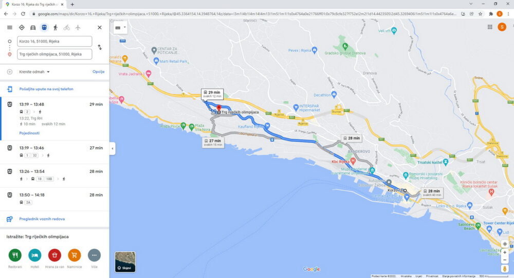
In cooperation with the utility company Autotrolej and company Exevio from Rijeka, Google Transit – public transport planning service – has been enabled within Google Maps for buses of Autotrolej as well.
Google Transit is a service that within Google Maps allows users a clear view of the route to the desired destination, that is, it specifies the time of departure of the means of public transport and all stations from the starting point to the destination. In this way, the user is directed towards the nearest bus station and is assisted while following the route from station to station.
In order to realise this service, Autotrolej provided access to a comprehensive database of all routes, timetables and other necessary data. After successfully cooperating with Google on the preparation and processing of line data, Rijeka received the Google Transit option for buses as well.
From now on, citizens and all Rijeka visitors have an overview of how to get to their destination by bus when searching locations on Google Maps. Transport information is accessed via Google maps on https://www.google.com/maps, where you need to click “Directions”, enter the starting point and destination or an address or the name of the location and then select the “Public Transport” icon.
This service will further improve the accessibility of Autotrolej to passengers because Google Transit connects users with the website of Autotrolej, which offers more detailed information on services and prices, while showing a clear bus route, remaining time until its arrival and all passing stations.
As the initiator of the project, Autotrolej, together with Exevio, plans to enable Google Transit users to monitor the movement of public transport in real time with a precise projection of bus arrivals.

